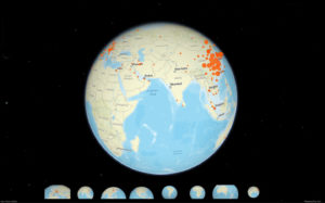
3D map of the world with cases of the COVID-19, also known as novel coronavirus. The map shows cases of infected people in all regions of the world.
Table of Contents
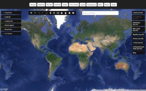
How to use the map
Press the left mouse button and hold. Now you can move the mouse in all directions and rotate the globe.
Press and hold the right mouse button and move up or down. So you change the angle of the stage.
Scroll and zoom in or out from the point where the cursor is. When approaching the ground, additional information about the point is displayed. Click on the point and you will get more information about the data source.
Data sources
The data have been compiled from a number of different sources like WHO, CDC, official government agencies, intergovernmental organizations. In each case, a source URL is linked in the popup.